

GIS-Based Multi-Criteria Decision Analysis (MCDA-AHP) for Flood and Landslide Susceptibility Mapping and Urban Sprawl Assessment in the City of Mati, Davao Oriental, Philippines
DOI:
https://doi.org/10.59120/drj.v17i2.555Keywords:
Flood susceptibility, GIS-based MCDA-AHP, landslide susceptibility, urban sprawl, weighted overlay analysisAbstract
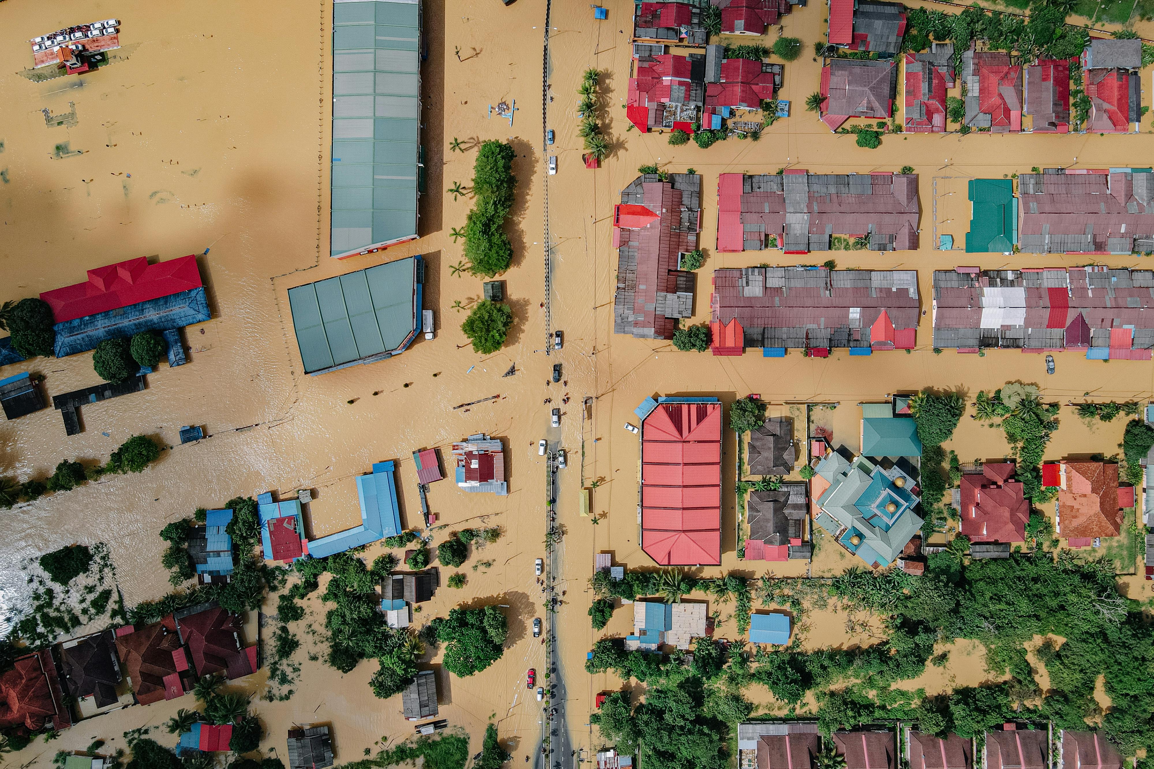
Flooding and landslides pose persistent and compounding risks in the City of Mati, Davao Oriental, Philippines, where rapid urban expansion increasingly intersects with hazard-prone landscapes. This study applied a Geographic Information System (GIS)-based Multi-Criteria Decision Analysis integrated with the Analytical Hierarchy Process (MCDA-AHP) to generate spatially explicit flood and landslide susceptibility maps and examine their interaction with urban sprawl from 2017 to 2024. Flood susceptibility was modelled using slope, elevation, rainfall, land use/land cover, and topographic wetness index, while landslide susceptibility incorporated slope, rainfall, soil type, erodibility, clay content, and land cover. Weighted overlay analysis produced composite hazard maps that were subsequently integrated with urban growth data. Results indicate that approximately 2,458.66 hectares are highly susceptible to flooding, primarily in low-lying coastal barangays, while 10,267.15 hectares are highly prone to landslides in steep upland areas. Urban expansion increased from 1,864.21 hectares in 2017 to 3,181.88 hectares in 2024, with significant encroachment into high-risk zones. This spatial convergence of hazards and development intensifies exposure, particularly in densely populated and rapidly developing communities. The study demonstrates the effectiveness of GIS-based MCDA-AHP as a decision-support tool for multi-hazard assessment and highlights the urgent need for risk-informed land-use planning. Integrating hazard-susceptibility maps into local policies, zoning regulations, and infrastructure planning is critical to minimizing disaster impacts and guiding sustainable urban development. These findings provide a robust scientific basis for enhancing resilience and adaptive capacity in hazard-prone coastal and upland environments.
Downloads
References
Akıncı, H., Yavuz Özalp, A., and Turgut, B. (2013). Agricultural land use suitability analysis using GIS and AHP technique. Computers and Electronics in Agriculture. 97, 71-82. https://doi.org/10.1016/j.compag.2013.07.006
Amini, S., Rohani, A., Aghkhani, M. H., Abbaspour-Fard, M. H., and Asgharipour, M. R. (2020). Assessment of land suitability and agricultural production sustainability using a combined approach (Fuzzy-AHP-GIS): A case study of Mazandaran province, Iran. Information Processing in Agriculture, 7(3), 384–402. https://doi.org/10.1016/j.inpa.2019.10.001
Cabrera, J. S., and Lee, H. S. (2020). Flood risk assessment for Davao Oriental in the Philippines using geographic information system-based multi-criteria analysis and the maximum entropy model. Journal of Flood Risk Management, 13(2), e12607. https://doi.org/10.1111/jfr3.12607
Downloads
Published
Issue
Section

License
Copyright (c) 2026 Ramil L. Ramos, Jonathan S. Cabrera

This work is licensed under a Creative Commons Attribution-NonCommercial 4.0 International License.
DRJ is an open-access journal and the article's license is CC-BY-NC. This license allows others to distribute, remix, tweak, and build on the author's work, as long as they give credit to the original work. Authors retain the copyright and grant the journal/publisher non-exclusive publishing rights with the work simultaneously licensed under a https://creativecommons.org/licenses/by-nc/4.0/.